What Is the Best Motorcycle Navigation Setup for Canada?
Canadian touring exposes a weak navigation setup fast: long stretches with no cell signal, sudden weather, road closures, and gaps of 100+ km (62+ mi) between fuel stops. Here is a practical guide to building a setup that actually works when you are two hours past cell coverage.
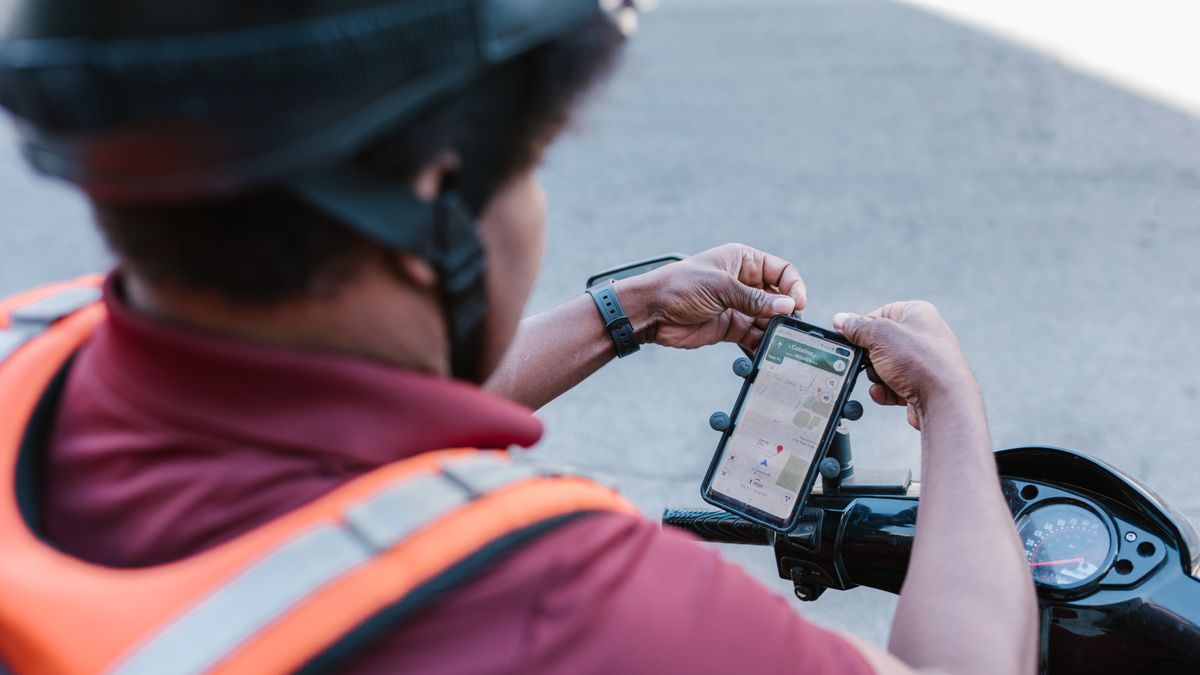
Table of Contents
Why Canadian touring is different
Riding in Canada presents unique navigation challenges that most US or European riders never face. The Trans-Canada Highway has stretches of 200+ km (124+ mi) with no cell signal, no fuel, and no services. In Atlantic Canada alone, the Cabot Trail, Gaspé Peninsula, and rural New Brunswick all have dead zones where a phone relying on live data goes blank right when you need it most.
I have ridden over 200,000 km (124,000 mi) across Canada, including the Cabot Trail, Newfoundland, and the ECIC Muskoka run. My navigation setup has failed me exactly when I needed it most — on a remote stretch of Highway 11 in New Brunswick where construction rerouted traffic and my phone showed a blank map because it had no data connection. That day taught me that "good enough around town" is not good enough for Canadian touring.
Phone navigation: enough for most riders
A phone running Google Maps, Rever, or Calimoto handles the vast majority of touring routes without any extra hardware. The screen is bigger and brighter than most dedicated GPS units, and the map data is more current. For 80% of your riding — highways, secondary roads, and populated areas — a phone is the best tool.
The gap shows up in exactly the places you expect: rural New Brunswick, the Cabot Trail, Gaspé, Newfoundland, and northern Ontario all have long dead zones. If your phone depends on live data for maps, you will lose navigation when you lose signal. The fix is not a different device — it is offline maps plus reliable power.
Key phone setup tips:
- Mount position: Mount the phone where you can see it without taking your eyes far from the road. A handlebar mount or mirror-stem mount works best. Avoid tank mounts — you cannot read them while riding.
- Screen brightness: GPS navigation runs the screen at full brightness, which drains the battery fast. Set auto-brightness to maximum or use a brightness boost app.
- Glove-friendly case: A touchscreen does not work with standard motorcycle gloves. Use a phone mount that allows glove-friendly interaction, or program your route before you start riding.
Build in power: USB-C on the bike
A phone running full-brightness navigation and GPS continuously will drain its battery in 2-4 hours. For full-day rides, a dedicated USB-C feed from the bike is not optional — it is mandatory. Here is what works:
- Motorcycle USB-C outlet: Wire a USB-C outlet directly to the battery with an inline fuse (5A minimum). Look for one rated for at least 30W (5V/3A or USB-PD). Brands like Oxford, Denali, and Rugged Road make reliable motorcycle-specific outlets.
- Install location: Mount the USB outlet where it is accessible but protected from rain. Under the seat or inside a fairing pocket works. Run the cable along the frame using zip ties and avoid routing near exhaust pipes.
- Battery drain concern: A USB outlet wired to the battery draws a tiny amount of current even when nothing is plugged in. If your bike sits for weeks, this can drain the battery. Use an outlet with a built-in on/off switch, or wire it through a relay that only activates when the ignition is on.
- Charging while riding: A 30W outlet keeps a phone running indefinitely at navigation brightness. A 15W outlet (older USB-A) may barely keep up — the phone might still drain slowly with GPS and screen at max.
Weatherproofing your setup
Most phones are splash-resistant (IP67 or IP68), but none are designed for hours of highway rain at 100 km/h (62 mph). You need genuine weather protection:
- Waterproof case or mount: Quad Lock makes a weatherproof poncho that covers the phone while mounted. For heavier rain, a fully sealed mount like the RAM X-Grip with a weather cover is better.
- Vibration dampening: Motorcycle engine vibration can damage phone camera OIS (optical image stabilization). Apple has acknowledged this issue. Use a vibration-damped mount — Quad Lock with the vibration dampener accessory, or a mount with built-in isolation.
- Screen readability in rain: Rain on the screen makes touch controls unreliable. Program your route before you start riding, and use voice navigation so you do not need to interact with the screen in bad weather.
- Condensation: In a sealed case, phone heat plus cold rain can cause condensation inside the case. If your phone fogs up, pull over and let it dry. Water inside a sealed case can cause damage.
Download offline maps before leaving
This is the single most important step for Canadian touring. Download your route maps the night before, on Wi-Fi, for every app you plan to use:
- Google Maps: Settings > Offline maps > Select your own map. Download a large enough area to cover your entire route plus a 50 km (31 mi) buffer for detours. Google Maps offline maps expire after 30 days unless updated.
- Apple Maps: Apple Maps now supports offline downloads on iOS 17+. Download the region covering your route.
- OsmAnd: Open-source maps app with excellent offline support. Download entire provinces at once. Good for backroads and trails that Google Maps does not show.
- Rever / Calimoto: Ride-tracking apps can record your route even without signal, but check whether their turn-by-turn navigation works offline before relying on it.
- Gaia GPS: Best for adventure riders who go off-road. Topographic maps with full offline support. Subscription required.
Test your offline maps before the trip. Put your phone in airplane mode and navigate to your destination. If it works, you are ready. If it does not, re-download and try again.
Dedicated GPS vs phone: the real comparison
Some riders swear by dedicated GPS units like the Garmin Zumo or TomTom Rider. Here is the honest comparison:
| Factor | Phone | Dedicated GPS (Zumo/Rider) |
|---|---|---|
| Map freshness | Excellent (live updates) | Good (requires manual updates) |
| Offline capability | Good (if pre-downloaded) | Excellent (maps stored locally) |
| Weather resistance | Poor (needs case) | Excellent (IPX7+ rated) |
| Vibration resistance | Poor (OIS damage risk) | Excellent (built for motorcycles) |
| Battery life | 2-4 hours (needs bike power) | 4-6 hours internal battery |
| Screen quality | Excellent (high-res OLED) | Adequate (designed for sunlight) |
| Price | $0 (already owned) + $80 mount | $400-$700 |
For most riders, a phone with offline maps, reliable power, and weather protection is the better choice. Dedicated GPS makes sense if you ride in extreme conditions regularly, want a device that does not drain your phone battery, or ride internationally where you do not have a cell plan.
Apps that work without signal
Not all navigation apps work offline. Here is what actually works in dead zones:
- Google Maps (offline mode): Works for turn-by-turn navigation if you downloaded the map area. Lane guidance and traffic data are unavailable offline.
- Apple Maps (offline): Works on iOS 17+ with pre-downloaded regions. Turn-by-turn directions function offline.
- OsmAnd: Fully offline. Excellent for backroads and trails. The interface is clunky but the map data is comprehensive.
- Gaia GPS: Fully offline with topographic maps. Best for adventure and off-road riding.
- Rever: Records your ride using GPS even without signal. Navigation requires online maps.
- Waze: Does not work offline at all. Do not rely on Waze for Canadian touring.
Carry a backup plan
Even the best setup fails. Always carry a backup:
- Printed maps: A provincial road map weighs nothing and never runs out of battery. Buy one at a gas station or visitor centre.
- Charge your phone before riding: Start every day at 100%. If your bike's USB fails, you still have several hours of navigation.
- Carry a power bank: A 10,000 mAh power bank can charge a phone 2-3 times. Keep it in a jacket pocket for emergencies.
- Know your fuel range: In remote areas, fuel is the real navigation concern. Know your bike's range and where gas stations are. The Indian Pursuit has a 22.7 L (6 US gal) tank with a range of approximately 390 km (242 mi).
- Tell someone your route: If you are riding solo in a dead zone, share your planned route and expected arrival time with someone. If you do not show up, they know where to look.
Related Articles
Best Time to Tour Atlantic Canada by Motorcycle — Full Guide How Much Does a 7-Day Motorcycle Trip Cost in Canada? Atlantic Canada Motorcycle Ferry Guide: What Riders Need Best Drone Spots in Atlantic Canada for Motorcycle Riders |Frequently Asked Questions
Yes, if you add reliable USB-C power on the bike, download offline maps, and use a weatherproof mount. The phone is the best navigation tool for 80% of riding. The other 20% requires offline preparation.
Not for most riders. A dedicated GPS makes sense if you ride in extreme weather regularly, want to preserve your phone battery, or ride internationally. For most Canadian touring, a phone with offline maps is sufficient and more cost-effective.
Google Maps (with offline downloads), Apple Maps (iOS 17+ offline), OsmAnd, and Gaia GPS all work without cell signal. Waze does not work offline. Download maps the night before your ride.
Wire a motorcycle-specific USB-C outlet to your battery with an inline fuse. Look for at least 30W output. This keeps your phone running indefinitely at navigation brightness. A 15W outlet may not keep up with GPS and full screen brightness.
Information checked August 25, 2026. Verify app compatibility and offline map availability for your specific device and region before touring.