Riding Highway 28 Through Algonquin: Ontario's Best Kept Motorcycle Secret
Most eastern Canadian riders know about the Cabot Trail, the Icefields Parkway, and the Sea-to-Sky. Fewer talk about Highway 28 through and around Algonquin Provincial Park — and I only found it because it was part of my return route from the ECIC Muskoka trip. It's one of the best stretches of motorcycle road in Ontario, and most riders from outside the province have never ridden it.
The Route Context
On the return leg from Muskoka — one of many group rides I've done with friends over the years — our group came back through Renfrew, then picked up Highway 28 heading south toward Peterborough. The stretch between Bancroft and Apsley runs through the southern edge of Algonquin Provincial Park's sphere of influence — dense Canadian Shield forest, mirror-flat lakes, long sweeping curves through granite cuts, and almost no traffic on a weekday.
The Road Itself
Highway 28 is a two-lane provincial highway in good condition through most of its length — well-paved, clear sight lines, consistent curve radii that reward smooth, deliberate riding. It's not a technical mountain pass. It's the kind of road where you settle into a rhythm and the kilometres disappear. The Canadian Shield rock cuts on either side frame the road beautifully in the morning light.
Table of Contents
The speed limit through the corridor is 80–90 km/h (50–56 mph) and it's appropriate — not because the road is slow, but because you'll want to slow down to actually look at what's around you.
Fuel and Distance Planning
This is important. Fuel stops thin out through the Algonquin corridor. If you're on a touring bike with a large tank you'll be fine, but plan your fuel stop before entering the longer stretches. On the Indian Pursuit with the 22.7L (6.0 US gal) tank and averaging 5.8 L/100km (40.6 mpg US), I have approximately 390 km (242 miles) of range — more than enough. On a smaller-tank bike, top up in Bancroft before heading into the corridor.
Wildlife Warning — Take This Seriously
Algonquin region means moose country. Moose are active at dawn and dusk, and they do not yield to motorcycles. A moose strike at highway speed is a survival situation. I ride with my high beams on during low-light hours through this corridor and I scan the shoulders constantly. This is not paranoia — locals know it's a real risk and they drive accordingly. So should you.
Bear and deer crossings are also common. Slow down and stay alert, especially in the first and last two hours of daylight.
Best Time to Ride
Late June through early October is the sweet spot. July and August offer warm temperatures — typically 22–28°C (72–82°F) through the day — with low humidity compared to coastal New Brunswick. September is arguably the best month: fall colours start coming in by mid-September, traffic drops, and the light is incredible in the morning hours. October is possible but temperatures can fall sharply — plan for 8–12°C (46–54°F) mornings.
Ottawa → Renfrew (fuel) → Barry's Bay → Bancroft (fuel) → Highway 28 south → Peterborough → return via Highway 7
Distance: ~650 km (404 miles) round trip
Riding time: 7–8 hours with stops
Drone Note
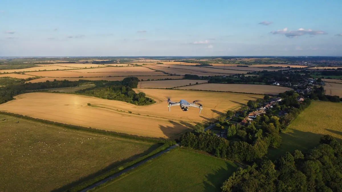
Algonquin Provincial Park prohibits drone use within park boundaries — this applies to all drones including sub-250g models like my Antigravity A1. The best aerial shots on this route are from the lookout points and scenic pull-offs outside the restricted zones. Obey the rules — the park is worth protecting.
What to Combine It With
Highway 28 pairs well with a Muskoka destination — Huntsville, Bracebridge, and Gravenhurst are all within reach and offer excellent overnight options. If you're doing a multi-day loop from eastern Ontario or Quebec, building the Muskoka–Highway 28–Peterborough corridor into your route is an easy win.
Frequently Asked Questions
Is Highway 28 through Algonquin Park good for motorcycles?
Highway 28 through Algonquin Provincial Park is one of Ontario's best motorcycle roads. It features sweeping curves, smooth pavement, minimal traffic, and stunning scenery through Canadian Shield landscape. The section from Renfrew to Bancroft is particularly rewarding for riders.
How long does it take to ride Highway 28 through Algonquin Park?
The full stretch of Highway 28 from Renfrew to Bancroft takes approximately 2 hours of riding time at a touring pace. Add extra time for fuel stops, photo opportunities, and breaks. Plan for a half-day if you want to enjoy the scenery and stops along the way.
When is the best time to ride Highway 28 in Algonquin Park?
The best time to ride Highway 28 is from late May through early October. September is ideal for fall colors. Avoid riding in early spring when road conditions can be unpredictable after winter. Check for road closures and construction before departing.
Are there gas stations on Highway 28 through Algonquin Park?
Gas stations are available in Renfrew at the start and Bancroft at the end, but options are limited through the park section itself. Fill up in Renfrew and plan for a range of at least 200 km (124 miles) between fuel stops.
Buy on Amazon
Affiliate Disclosure: As an Amazon Associate I earn from qualifying purchases. If you buy through these links, I may earn a small commission at no extra cost to you.